Landscape with trees and water
Operable Unit One (OU1)
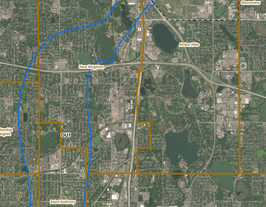
OU1 is the largest portion of the affected groundwater plume, which extends southwest of TCAAP. OU1 is also known as the North Plume and OU3 as the South Plume.
The primary chemical of concern (COC) for OU1 is trichloroethene (TCE), with other related compounds in lower concentrations. Monitoring efforts have displayed continuous progress towards aquifer restoration. The Army is actively addressing 1,4-dioxane within the plume.
Current remedies in place include groundwater extraction and treatment, discharge of treated water, providing well abandonment and alternative water supply for residents with private wells located
Operable Unit Two (OU2)
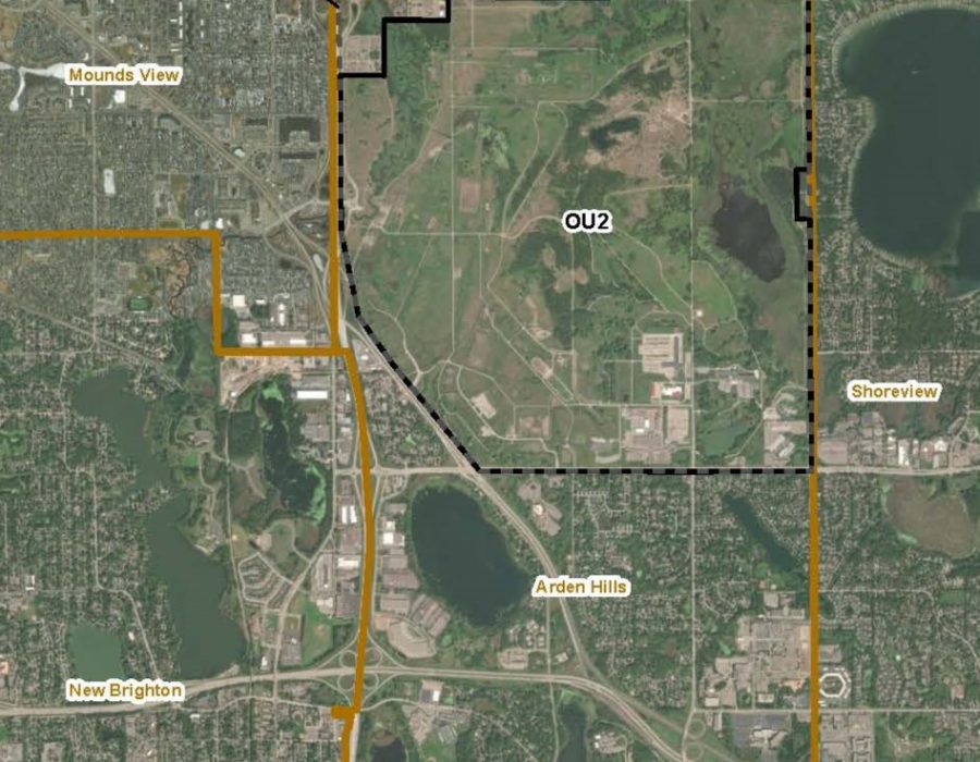
OU2 contains all the sites located within the boundaries of TCAAP: Sites A-K, Buildings 102, 129-3, 129-5, 129-15, Grenade Range, Outdoor Firing Range, MNARNG EBS, 135 PTA, Water Tower Area, Recreational Trap Shooting Range, Aquatic Sites, Building 535 PTA, AEC Phytoremediation Demo Area, and All Uncharacterized Map of OU2bAreas (TCAAP-26).
These sites are all subcategorized by shallow/deep groundwater/soil.Additional details on each remedial action can be found in the most recent APR.
Click here to see a map of OU2 and description of the Sites.
Operable Unit Three (OU3)
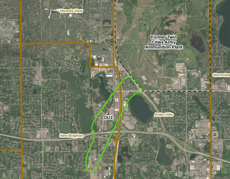
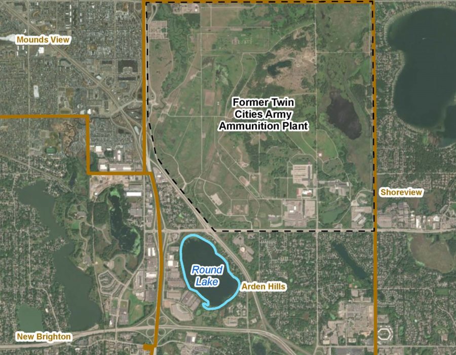
OU3 is a portion of the affected groundwater plume located off the TCAAP site, known as the South Plume. It lies southeast of OU1 and directly south of TCAAP, as shown on the site map.The primary COC for OU3 is TCE, as well as more recent monitoring of 1,4-dioxane which is contained within areas where LUCs are in place to prevent usage of affected groundwater.
Active groundwater treatment systems functioned to remove and treat affected groundwater from 1994 to 2001, when the system was shut off after data showed that the southern plume had greatly reduced in size and in COC concentrations.
Sampling data showed that during this time, the plume migrated upgradient (towards the source area).
Round Lake
Round Lake is an aquatic site that covers approximately 154 acres of shoreline and lake (including approximately 29 acres of upland) and was incorporated into TCAAP in the 1940s. The area of the watershed surrounding Round Lake is 465 acres. Historical natural inlets were replaced by storm sewer systems, including two currently associated with drainage from the former TCAAP. Ownership of Round Lake was transferred from the U.S. Army to the U.S. Fish and Wildlife Service (USFWS) National Wildlife Refuge System in April 1974 and the area is designated as the Round Lake Unit of the Minnesota Valley National Wildlife Refuge. The Round Lake Unit provides habitat for both terrestrial and water-dependent wildlife.
